

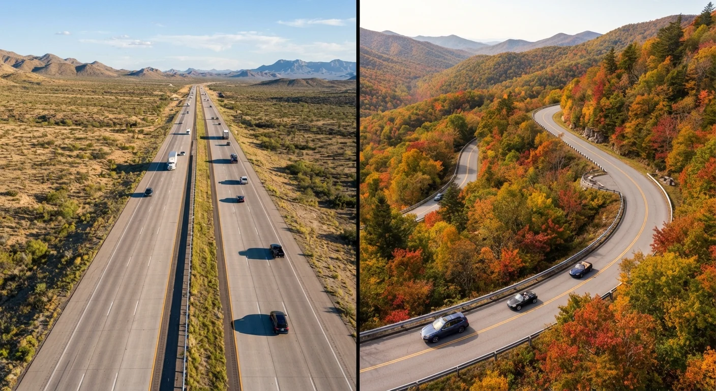
Option A
Interstate Highway
The fast, predictable backbone of American road travel.
Best for: Drivers who need to cover long distances efficiently with consistent amenities and minimal detours.
Option B
Scenic Byway
The immersive, landscape-first alternative for explorers.
Best for: Travelers who want the journey itself to be the destination, with unique stops and natural beauty along the way.
What Separates These Two Road Types
Interstate highways form the backbone of the U.S. road network - a federally standardized system designed for high-speed, high-volume travel across state lines. They feature controlled access, consistent signage, regular rest areas, and a density of fuel stations and services that makes logistics predictable. When you're behind the wheel of an interstate, the road largely takes care of itself.
Scenic byways are a different proposition entirely. The Federal Highway Administration's National Scenic Byways Program designates routes based on six intrinsic qualities: scenic, natural, historic, cultural, recreational, and archaeological value. These roads weren't built for efficiency - they were preserved or recognized for what surrounds them. Think two-lane mountain passes, coastal cliff roads, and routes through small towns that interstate bypasses left behind.
The core tradeoff is simple: interstates trade beauty for speed; byways trade speed for immersion. Understanding that tension is the starting point for any honest route decision. For a broader look at how route selection shapes your whole trip, this route planning guide covers the full evaluation process.
| Criterion | Interstate Highway | Scenic Byway |
|---|---|---|
| Travel Speed | High (65-80 mph typical) | Lower (35-55 mph typical) |
| Fuel Stop Frequency | Every 30-40 miles on average | Can exceed 80+ miles between stops |
| Cell Service Reliability | Generally consistent | Frequently limited or absent |
| Scenic & Cultural Value | Minimal - functional corridor | High - federally designated for it |
| Emergency Services Access | Frequent and well-marked | Sparse; plan ahead |
| Lodging Availability | Abundant near exits | Limited; reservations recommended |
| Road Condition Consistency | Federally standardized, well-maintained | Varies; some roads are narrow or unpaved |
| Best Companion Profile | Families, schedule-constrained travelers | Flexible travelers, solo or couples |
Time, Services, and Safety Considerations
Travel time is the most immediate practical difference. A scenic byway covering the same geographic distance as an interstate stretch can easily take two to three times as long - due to lower speed limits, more frequent stops, winding roads, and seasonal traffic at viewpoints. This isn't a problem if time is built into your itinerary, but it becomes a real issue when travelers underestimate it.
Emergency services present a more serious consideration. Interstates are patrolled regularly, have emergency call boxes at intervals, and run through or near urban areas with hospitals and mechanics. Many scenic byways, by contrast, pass through remote stretches with limited cell signal, sparse population, and long gaps between service towns. Carrying a roadside emergency kit and downloading offline maps before departing on a byway route is not optional - it's prudent preparation.
150+
Designated National Scenic Byways in the US
The Federal Highway Administration's National Scenic Byways Program recognizes routes across all 50 states based on six intrinsic quality criteria.
~48,000
Miles in the US Interstate Highway System
The Interstate Highway System, initiated under the Federal Aid Highway Act of 1956, now spans approximately 48,000 miles across the continental United States.
2-3×
Longer travel time on scenic byways vs. interstates
For equivalent geographic distances, scenic byway travel commonly takes two to three times longer due to lower speed limits, road geometry, and frequent stops.
Fuel planning also differs meaningfully. On an interstate, a general guideline is to refuel when your tank drops to around a quarter full, since stations are rarely more than 30-40 miles apart. On a scenic byway, gaps of 80 miles or more between fuel stops are common in rural or mountainous areas. Check your route in advance and top off before entering remote segments. The Complete Road Trip Planning Playbook covers emergency kit essentials and route preparation in detail.
When to Choose Each - and When to Combine Them
Choosing between an interstate and a scenic byway isn't always an either/or decision. Many experienced road trippers use interstates to cover ground efficiently and then drop onto designated byways for specific regional segments where the landscape or history justifies the slower pace. California's Pacific Coast Highway, for instance, makes sense as a deliberate byway experience - each stretch offers something distinct, from Big Sur's cliffs to the beach towns further south - while an interstate handles the long approach from inland.
Consider your travel companions, too. Families with young children or passengers with health considerations generally benefit from the predictability of interstate travel: consistent rest stops, nearby medical facilities, and maintained road surfaces. Solo drivers or couples with flexible schedules are better positioned to absorb byway unpredictability and make spontaneous stops.
Overnight planning also shifts between road types. Scenic byways often pass through small towns with limited lodging inventory, meaning reservations matter more. Interstates run through or near larger towns with abundant motel and hotel options. If you're still figuring out your overnight strategy, this guide to overnight stays breaks down campgrounds, motels, and the options in between.
Hybrid Routes: The Best of Both Roads
You don't have to commit entirely to one road type. Many seasoned road trippers use the interstate to reach a region quickly, then switch to a scenic byway for the most rewarding segment of their journey. Navigation apps like Google Maps and Apple Maps allow you to add waypoints so you can plan these transitions in advance. Just build extra time into your schedule before making the switch - byway segments routinely take longer than their mileage suggests.
The content on this site is provided for informational purposes only and should not be considered a substitute for professional advice. While we strive to provide accurate and up-to-date information, we make no guarantees regarding its completeness or accuracy. Always consult a qualified professional for advice specific to your circumstances before making any decisions.